- Thumbnail
- Resource ID
- cd1a91a0-a6ac-4bc3-b6e0-8d027283fd7c
- Title
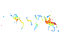
- Mangrove biomass (tonnes per hectare)
- Date
- Nov. 25, 2017, 7:42 a.m., Publication
- Abstract
- This dataset shows the modelled global patterns of above-ground biomass of mangrove forests. The dataset was developed by the Department of Zoology, University of Cambridge, with support from The Nature Conservancy. The work is based on a review of 95 field studies on carbon storage and fluxes in mangroves world-wide. A climate-based model for potential mangrove above-ground biomass was developed, with almost four times the explanatory power of the only previous published model. The map highlights the high variability in mangrove above-ground biomass and indicates areas that could be prioritised for mangrove conservation and restoration.
Legend: http://ec2-54-204-216-109.compute-1.amazonaws.com:6080/arcgis/rest/services/marine/TNC_001_GlobalMangroveBiomass2014/MapServer/legend
Source: http://data.unep-wcmc.org/datasets/39tare)
- Edition
- --
- Owner
- gridanode
- Point of Contact
- devrsgis@gmail.com
- Purpose
- --
- Maintenance Frequency
- None
- Type
- not filled
- Restrictions
- None
- License
- None
- Language
- eng
- Temporal Extent
- Start
- --
- End
- --
- Supplemental Information
- No information provided
- Data Quality
- --
- Extent
-
- long min: -180.0000000000
- long max: 180.0000000000
- lat min: -90.0000000000
- lat max: 90.0000000000
- Spatial Reference System Identifier
- EPSG:4326
- Keywords
- no keywords
- Category
- Oceans